Finding Every Solar Panel in the Nation with 90% AccuracyDate:
12/20/2018Tag: @Stanford #DeepSolarproject #DeepSolar #solarpanel #solarenergy #photovoltaics #psd Finding Every Solar Panel in the Nation with 90% Accuracy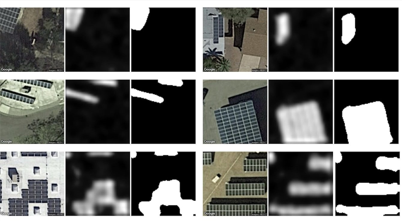 Stanford
Examples from the satellite images Here’s a national cataloguing project that’s only 10% creepy. The DeepSolar project aims to map every solar panel in the country using machine learning. And if you’re deeply intrigued and mildly disturbed at the idea of pinpointing the exact locations of a specific commodity across 3.5 million square miles, I’m right there with you. Stanford engineers Arun Majumdar and Ram Rajagopal wanted to use a common method (machine learning) to classify every solar panel nationwide with a high enough accuracy to assist national and state policy decisions. “We decided to share all of the work in open source to encourage others in industry and academia to utilize both the method as well as the data to produce more insights,” Rajagopal said. And since solar panels are normally situated in peak lighting conditions – i.e., highly visible locations – identifying them was that much easier. The team’s model focused on the lower 48 states, and while this does exclude significant mileage (and whole states), as TechCrunch points out, a lot of the exclusions include mountains and state parks, which aren’t ideal for solar panels. And while the project “only” covered about 6% of the entire country, it did include every urban area, which comprises 3.5% of the nation. All told, the team found 1.47 million individual solar installations (with 90% accuracy), and while the TechCrunch piece breaks it down in greater detail, one of the more interesting findings was that residential solar made up 87 percent of all installations but only 34 percent of the total solar cell surface area. Read more here: https://techcrunch.com/2018/12/19/this-project-is-mapping-every-solar-panel-in-the-country-using-machine-learning/ |